Community Mapping, Participatory Landscape Analysis & GIS Training Workshop
Tired. Very tired. I have just spent the last two weeks conducting a Geographical Information Systems (GIS) training workshop with my office, PSTEO, and some people from the District Agriculture and Forestry Office (DAFO). I have never seen my Lao counterparts get so excited and put so much effort into any activity we have conducted before. Usually, when you hold training, people tend to show up around 9am (if you scheduled to start at 8am), take a half an hour coffee break around 10am, and leave for lunch around 11:30. The afternoon usually gets going around 2 or 2:30 and everyone disappears around 4. This time around, people were showing up at 8am, no coffee break, and not leaving for lunch until 12:30! They were back like clockwork by 1:30 and many days we didn’t leave the office until 6 or even 7pm. Pretty incredible to say the least. It’s been a lot of fun as a result but very tiring as we have been keeping this schedule for the last 12 days straight.
The objectives of the training were as follows:
To provide participants with a basic understanding of the theory and practice of Geo-informatics and remote sensing
To provide participants with basic understanding and knowledge in the use of Arcview 3.2a (a GIS software package used for making maps and displaying spatial data)
To enable participants to conduct participatory community mapping (PCM) in villages with respect to land use and watershed management
To enable participants to correlate and confirm data taken from the PCM activities using baseline spatial data taken from external sources, and by using a Global positioning system.
To provide participants and PSTEO and DAFO the means and capacity to integrate basic GIS skills and knowledge into the planning and implementation processes regarding land use planning and watershed management
Activities
The first week we spent in a meeting room at the PSTEO offices with a GIS expert we flew up from Vientiane from the National Agriculture and Forestry Research Institute provided an introduction to GIS and using Arcview to make simple maps. Participants learned how to:
Create maps in arcview using base line data from NAFRI showing watershed boundaries and catchments, watershed classification, infrastructure, hydrology, land use planning, geo-referencing data, and displaying all this data in map layouts.
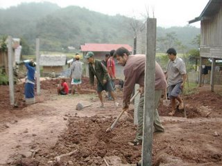
The second week, we headed out to a village (Ban phonhom) to conduct the PCM and participatory landscape analysis aspects of the training. Participatory mapping is conducted by using large (A0) base topography maps developed showing a digital elevation model with hill shading and contours. Over this way lay a transparent piece of paper and then work with the villagers to draw the village boundaries and all current land use activities. Also, the training workshop participants went into the field with the villagers and, using a clinometer, compass, and gps unit they learned to calculate slope and identify areas of the village that were susceptible to high erosion and sedimentation and thus potential risk areas to watershed functions and services. This took three days and ended, of course, with a big lao hai drinking party. (who would a thought!)
Once the field work was completed it was back to the office to digitize the maps we had made in the field. This is done by geo-referencing the transparent maps in Arcview overlaid with the gps data. What you end up with is a digital map of the transparent maps made by the villagers, which we can then overlay with the data given to us by NAFRI. This is what we just finished doing. The next step after the training will be to take all this data and use it to develop future strategies and land use and watershed management plans.
Overall, I have to say this has been my favorite workshop so far and can also say my own knowledge of GIS and arcview has increased tenfold.


0 Comments:
Post a Comment
<< Home